- Like
- Digg
- Del
- Tumblr
- VKontakte
- Buffer
- Love This
- Odnoklassniki
- Meneame
- Blogger
- Amazon
- Yahoo Mail
- Gmail
- AOL
- Newsvine
- HackerNews
- Evernote
- MySpace
- Mail.ru
- Viadeo
- Line
- Comments
- Yummly
- SMS
- Viber
- Telegram
- Subscribe
- Skype
- Facebook Messenger
- Kakao
- LiveJournal
- Yammer
- Edgar
- Fintel
- Mix
- Instapaper
- Copy Link
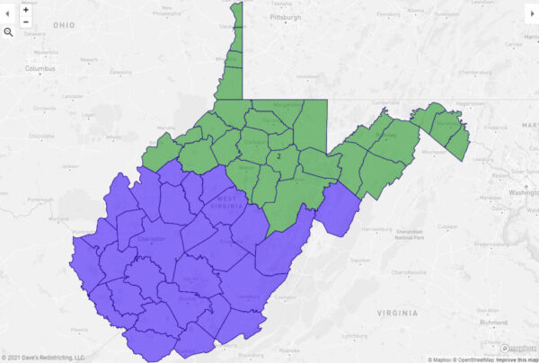
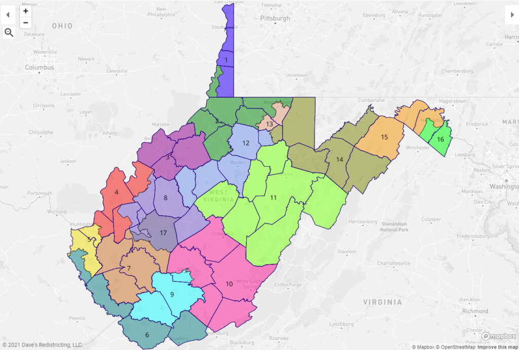
The new legislative and congressional maps can be viewed in various formats at https://www.wvlegislature.gov/redistricting.cfm.
To view the proposed plans in detail via Google Earth:
1) Under “Final Maps” download the [.KMZ] file for the Congressional, Senate or House Map from the Legislature’s redistricting website
2) Go to https://earth.google.com/web/
3) From the Menu in the sidebar, click Projects, then Open, then Import the KMZ/KML file from your computer.
To view via Dave’s Redistricting:
1) Go to https://davesredistricting.org/
2) From the home page, click WV on the map, then click “Redistricting Resources”, then “Official West Virginia Plans in DRA 2020”
3) You may be asked to set up an account, which is free. The new maps are the ones modified on Nov. 16. The other maps are the old/current maps populated with the latest census and voting age data.